Monday 27 October 2014

October 26, 2014 ….. Great Dismal Swamp … part one


again we were off the hook at first light and headed out to catch the bridge opening at 8:00


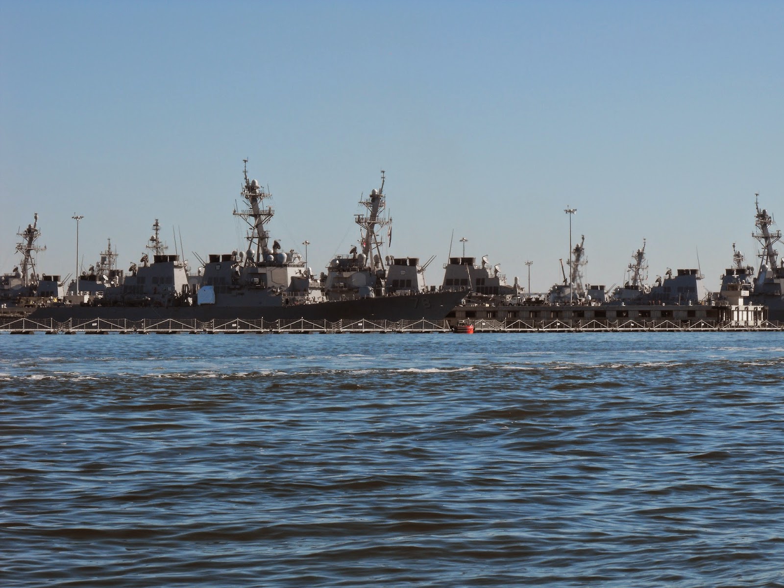
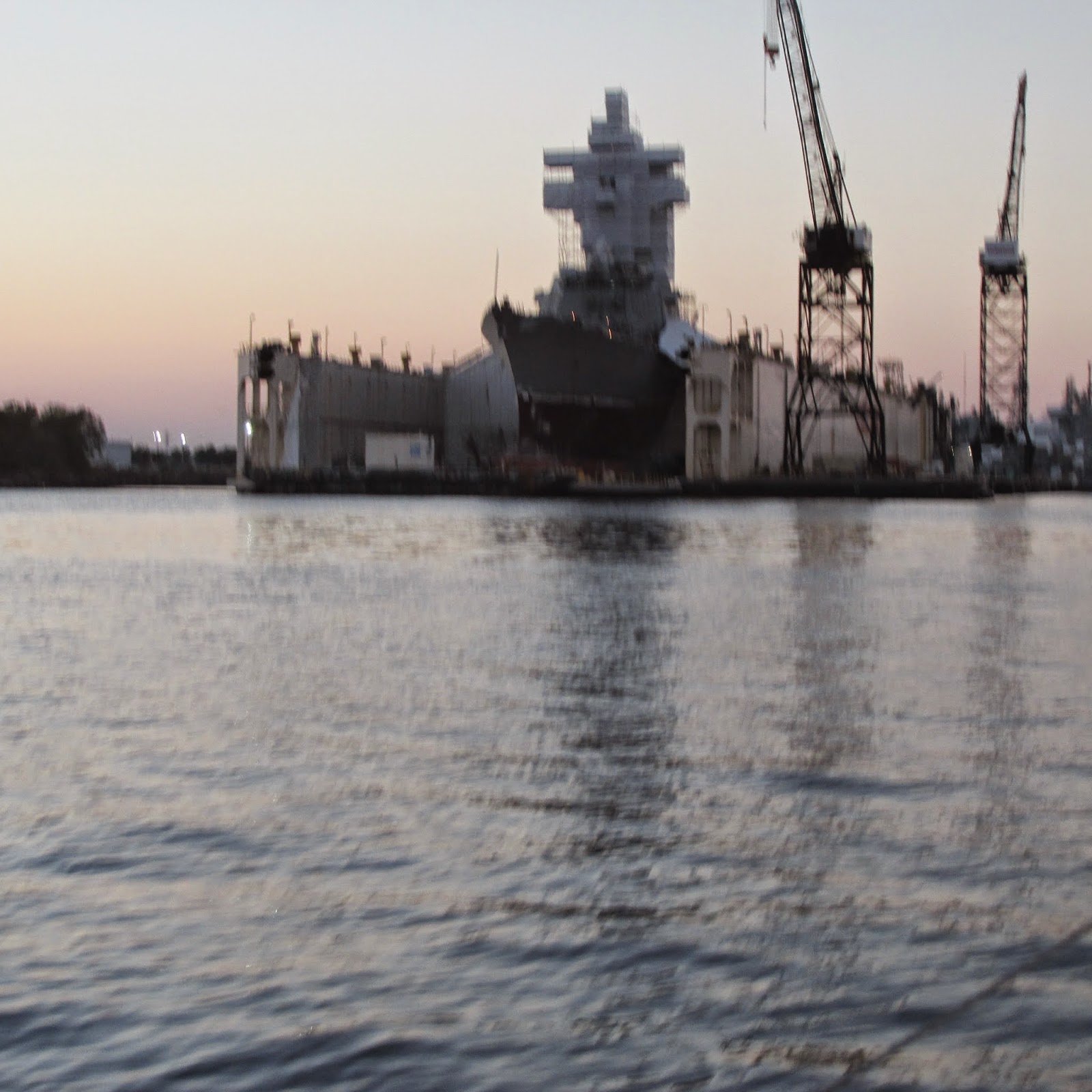
security on guard of a ship being built


the red line is floats and nets surrounding all the boats in the harbour, so enemy divers can't get at the Navy boats , while they are at the dock


this bridge is open, and about 5 boats are leaving, marinas etc to head out for the ICW


we just made the Gilmerton Bridge, by seconds, the siren was ringing as we just approached, next opening was in 1/2 hour …


entering the Great Dismal Swamp, it is about 30 feet wide at the entrance, and can be  easily missed, 

the Virginia Cut is right beside, and it is for boats that the mast is too high and over 6 ft draft, and this canal is for commercial traffic


trees are changing colour and lots of leaves in the water


luck was with us again, Deep Creek Lock was running behind schedule and the doors were open when we rounded the corner


it was time to get out of our survival suits, the heat of the day was upon us, and this is only 8:45 am

October 25, 2014 --- to Norfolk, Virginia


up and off the hook, with Funny Duck, and Snowbird, 7am is enough light to work your way-out , it took us about 15 minutes to do the dog leg in 6 ft depths around the shallows, last night a sailboat got stuck, by just going one foot off the path … this is Wolf Trap Lighthouse, red brick 55 ft, octagonal dwelling, with a square tower on top


entering Norfolk, Fort Wool on Port and Fort Monroe, Std.


Warship 55, just returning from the sea, we followed her in to her berth


aircraft carrier


warships lined up, Norfolk is the largest navel installation in the world, and is homeport for aircraft carriers, destroyers, frigates, nuclear submarines and admiral barges.


you have to keep at least 500 yards of Navy Ships


every where tugs are pushing and pulling barges, these tugs are hugh 


it is an amazing harbour to enter …


it was a long days travel, it was 10 1/4 hours, we had to leave against the tide and fought it all the way to Hospital Point, at one time we were only doing 2.5 knots … we had to leave at 7am to arrive before dark … this was the first time we bucked the currants and tides … to make a passage

Friday 24 October 2014

October 22 - 23, 2014 Gale Force winds Deltaville, Virginia


Wednesday was predicting gale force winds all day, so we decided to not leave like our friends on Jacob's Ladder and At Last … we moved over to Jackson Creek, about 5 miles away, to a more protected anchorage, there we anchored beside Snowbird, the depth was 9 feet, and we dug into the mud, about a foot … Joe just loves these swallow anchorages, less chain for him to haul


well we made the right decision, the wind howled all that day and night … surprisingly there was not much rain with it …. to my disappointment because I was counting on the rain to get enough fresh water to do laundry


we are right next to this 32 ft. motor sailor … more info on the boat later


another look at the sky the next day, and the gale force winds are continuing


Joe is planning our trip in the ICW, marking all the bridges, and times of openings, where to anchor and where there is free docks …  can't wait to get in there


on Thursday we headed into the closest marina with our diesel jugs, this was a long boat house, for the more privilege boaters … 


the name on this boat is RETIRED SAILOR III


we got our diesel back to the boat and then headed out with Janine and Dave to see the town, we went to West Marine, Hardware Store, Maine Consignment Store, Dollar store, and finally grocery store … where the manager for a $5.00 fee drove all our groceries and parcels back to the marina
Deltaville is very spread out about 4 miles long 

to our disappointment the Harbour Master the next day would not allow us to use the bikes, he said the girls in the office should of made us pay $11.00/day fee   … this fee also includes showers, wifi, laundry facilities, use of the van for one hour  

… we did not want the other facilities …and he would not budge
doesn't he realize we spend money when we go to town !!!!

October 21, 2014 on the water again


we left Back Creek, Solomons Island at first light, the oyster boats were  out already working 


we left with SNOWBIRD, Janine and Dave, from southern Ontario, originally from Vancouver
later we found out that they sailed the French Canals, the Med, crossed the Atlantic Ocean, up the ICW, etc.  and now heading down the ICW for the Bahamas once again


these are the crab pots markers that we try and avoid , very low in the water


these are the ones we can see easier and wish all of the markers look like this


 the last of the SW swells


we thought this schooner was quite low in the water


Point No Point Lighthouse, it is not on a point of land, so therefore the name


we are seeing our first pelicans


ocean fishing boat returning,……  on our charts we are seeing  markings showing Fishing Haven,
what I found out is, and they are all different …it is Outdoor Recreational Area Fishing ….good for catching for example, fluke, stripped bass, bluefish, atlantic croaker …. these are man made fishing havens, one of them is …..  bottom is sand and silty sand, reef material is 2 very large sunk barges, with a long row of woodrow wilson rubble,(what in heck is that), that is placed between the barges, depth is 30-35 ft, and covers
1,059 acres


this day turned out so beautiful, we even took turns up on the foredeck, with a drink in hand and soaked up the sun


a beautiful day on the water, 61 nm in 10 hours

October 20, 2014 ….. a walk around Solomons Island


we walked to Calvert Marine Museum, but it was already 3:30 and it closes at 5 pm, so we decided to not buy the seniors day pass, for only a few hours … this is another of the screw turn lighthouses, it has been moved to this site … Drum Point Lighthouse


a smaller "Skipjack", notice how flat the bottom is


the Govenor Thomas Johnson Bridge, crosses the Patuxent River and links Calvert and St. Mary's Counties, hight is 135 ft


our mile walk along the waterfront, and most of the places are already closed for the season


there was another boat built on the Chesapeake Bay called the "BUGEYE", we still haven't  seen one


these plaques can tell the story better than me


we did manage to find a small sand beach, and yes some more sea glass was added to our collection


we were trying to figure out how many boats are in this creek, and we came up with a minimum of ten thousand …. really !!


a good name


parking garage is under the house on stilts


we figured it was time to change out the guides, charts, maps etc.
so now we have the last part of the Chesapeake Bay, the ICW, and Florida …
the Bahamas are still packed away