we just passed thru the Current Cut and was surprised to
a local fishing boat in the calm waters
once thru the cut it calmed out and was a large vast body of water, but you still have to
stay in the channel for the next 6 miles
Rotten Bay anchorage
a good night
anchored off by the Glass Window
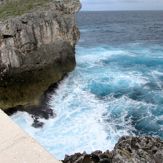
Glass window bridge with a wave passing under it
during storms the waves thru this opening and washed the guard rails away
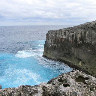
some views of the ocean
this boulder was thrown up on the cliff top during a storm
.. see Joe off to the right
a blow hole from the ocean
the road to the bridge
this is the guard rails that was washed out during a storm
lots of caves along the way
a village along the cut
the entrance to Hatchett Bay .. only 80-90 ft wide
Sunday January 24, 2016
The wind was still blowing hard in the morning, so we delayed our departure off the mooring balls until 11:45. All 7 boats left. Four of us headed to the Currant Cut and 3 to Harbour Island. We had the foresail up and slowly sailing. It is advisable to go through the cut 2 hours after high
or low tide at Nassau. So the time today was 4:15pm, low tide, but you can also pass one hour before or one hour after the slack.
At 1:30 Grace entered, with Moonlight Maid following, they radioed back and said they had 3 1/2 knots against them and lots of rocking and rolling, not an easy passage.
at 2:45 Lagom and Snowbird went through with 1 1/2 knots against them and lots of rocking and rolling, it was a doable passage, but uncomfortable
at 3:15 Modaki went through with .5 knots against us and we surfed the waves and NO rocking and rolling. We are happy we waited for the advisable time, also we are the smallest boat in this fleet.
We all ended up at Rotten Bay, Eleutheras by 5pm, and had a calm, windless night.
Monday January 25, 2016
Anchor up at 8am and we motored in flat seas about 5 miles to The
Glass Window and Bridge. This is the skinniest part of
Eleuthera, which is just 30 ft wide. The land here is high on either side and abruptly falls away to nearly sea level almost dividing the island in two. You can stand in one spot and see the gray Atlantic Ocean to the east and Exuma Sound to the west.
When the Atlantic Ocean rollers come surging in, or the powerful
swells of a distant mega storm, 3,000 miles of ocean fetch hits
that rock spine beneath the bridge and can throw walls of water 100-200 feet high and will carry away anything on the bridge. It has
happened more than once, including removing the bridge itself.
Then we moved down to Hatchet Bay Harbour, the entrance is 80-90 feet
wide and is man made, formed by cutting through the limestone cliff to
form an entrance into a landlocked pond, this was carved out just after
WWI. The harbour was planned to use it to load quarried stone from the island onto ships bound for construction projects in Nassau and the U.S.,
but it failed. In the 1970's the Hatchet Bay cattle-raising project started and it too failed. We could see about 10 silos in the hill tops as we came down the coast, all vacant now.
It took us a while to find an anchoring spot, and we ended up in 25 ft of water, which is unusual for the Bahamas, with 150 ft of chain and some rode … there is another low coming in a few days.
We hope to get to town tomorrow …..


No comments:
Post a Comment